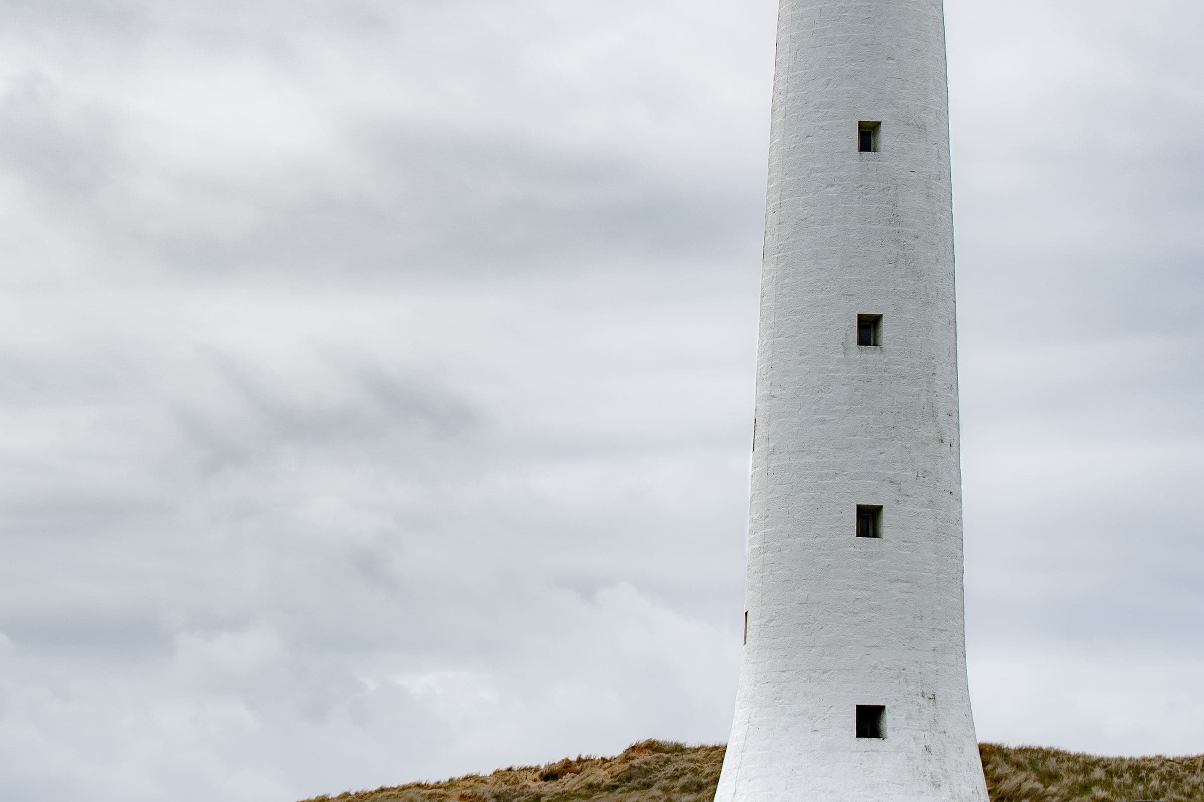
King Island Council opens with history: shipwrecks, lighthouses, jagged reefs. It is not being poetic for a brochure. The Australian Maritime Safety Authority still lists Cape Wickham as heritage place 35 in its 2022–2025 strategy because the western entrance to Bass Strait had to be lit.
Cape Wickham Lighthouse
AMSA’s sentence is the one we keep:
Constructed in 1861 and standing 48 m, Cape Wickham lighthouse is the tallest in Australia, and one of a series of lighthouses erected to light the dangers of King Island and the western entrance to Bass Strait.
We will not upgrade that to “tallest in the Southern Hemisphere.” Other towers elsewhere contest that slogan; AMSA does not use it.
The light is an active aid. Interior access is an operator and safety question, not a tourist right. Tourism Tasmania’s golf fact sheet notes the northern course is positioned around the lighthouse — a modern land use beside a nineteenth-century answer to a body count.
A longer walk through lights and wrecks sits in the lighthouse guide.
The Cataraqui
AMSA, in the same heritage paragraph, says King Island “was the scene of Australia’s largest maritime disaster when the emigrant ship Cataraqui wrecked, with the loss of 400 lives.” We quote that figure as AMSA’s figure. Memorials and exact landing places belong to on-island interpretation and heritage registers. This page will not turn a grave coast into a scavenger hunt.
Discover Tasmania’s King Island copy — “the ocean is life… but it’s also been death” — is the visitor-facing version of the same fact.
After the wrecks: pasture
The other history, the one council tells with food, is agricultural. People stayed. They farmed in wind. They made the produce names that still travel. That is not a lesser story. It is why Produce sits beside this hub, and why a 2009 brand site on this domain could exist at all.
We do not write a full settler-and-dispossession history in 1,200 words. Tasmanian Aboriginal people are the first peoples of this island; Parks Tasmania’s own walk pages open with an acknowledgement. For deep history, use First Nations sources, the Tasmanian Aboriginal Centre, and museum interpretation — not a visitor guide pretending to be a journal article.
The URL you thought this was
History.aspx on the 2009 dairy site was “King Island History” in a brand menu, sitting between Products and Awards. That file is gone. The 301 lands here so a backlink still resolves to real sentences. If you wanted cheese-style chronology, see Produce and the independence note on About.
Museums and interpretation
Small-island museums and heritage rooms open when a person can open them. We will not publish a ticket price or a winter roster. If official tourism lists a collection, confirm the day. If a board by a memorial is the interpretation, read the board as if it were the primary source in front of your face — because it is.
What not to take home
Wreck coasts accumulate stories and, sometimes, objects. Taking them is how visitors become the next problem in a heritage file. Photograph, leave, drive in daylight.
The golf course as a modern chapter
Tourism Tasmania’s fact sheet placing a links around the 1861 tower is not a punchline. It is the latest land use on a headland that exists because ships died. Play if you booked. Still read the plaque.
Chronology we will not invent
A visitor-guide history that starts in 1800s wrecks and ends in a golf fact sheet is already a sketch. We will not fill the centuries between with unsourced settlement romance, unsourced military footnotes, or a dairy-company timeline copied from 2009. When a primary page gives us a dated sentence, we add it. Until then, the spine stays: Strait, wreck, light, pasture, modern visitor uses.
If you need a deeper chronology, use heritage registers, Trove, and First Nations sources. This page is the doorway, not the archive.
How to spend a history day without becoming a collector
Morning: the official tower if the road and weather allow. Midday: Currie interpretation if a room is open. Afternoon: a specified walk on the same coast that made the lights necessary. Evening: the produce story, which is what people did after they stopped dying on the reef. That day has no souvenir requirement.
How this hub sits beside golf and walks
The tower is on the golf fact sheet and on AMSA’s heritage list. The coast is on Discover Tasmania’s walk copy and on AMSA’s disaster sentence. Read this hub before you treat either as scenery only.
How this hub uses numbers
Three figures on this page come from AMSA’s heritage strategy: 1861, 48 m, and 400 lives on the Cataraqui. Council’s 64 km by 27 km sits on the home and towns pages. We will not add a wreck count, a “more than N wrecks” slogan, or a population-through-time chart unless a named official table supplies it.
Reading this hub before a cape day
If tomorrow is Cape Wickham, read this page tonight and the lighthouse guide in the morning. The tower is an aid to navigation first. Tourism Tasmania’s golf fact sheet placing a course around it is a modern land-use note, not a reason to treat the headland as a theme park.
Questions people actually ask
Why are there so many shipwrecks around King Island?
Official heritage material places King Island on the western entrance to Bass Strait, a historically lethal approach. AMSA says a series of lighthouses, including Cape Wickham (1861), was erected to light those dangers after wrecks that included the Cataraqui.
Is Cape Wickham the tallest lighthouse in the Southern Hemisphere?
AMSA’s wording is that the 48-metre Cape Wickham tower is the tallest lighthouse in Australia. We stay with that official claim and do not repeat the wider Southern Hemisphere slogan.
Is this the old King Island Dairy history page?
No. History.aspx 301s here. The old page was brand history. This page is island history from council and AMSA.
What belongs on the history hub?
AMSA’s Cape Wickham facts (1861, 48 m, tallest in Australia), the Cataraqui sentence, council’s wreck-and-light opening, and a clear note that this is not the 2009 dairy History.aspx.