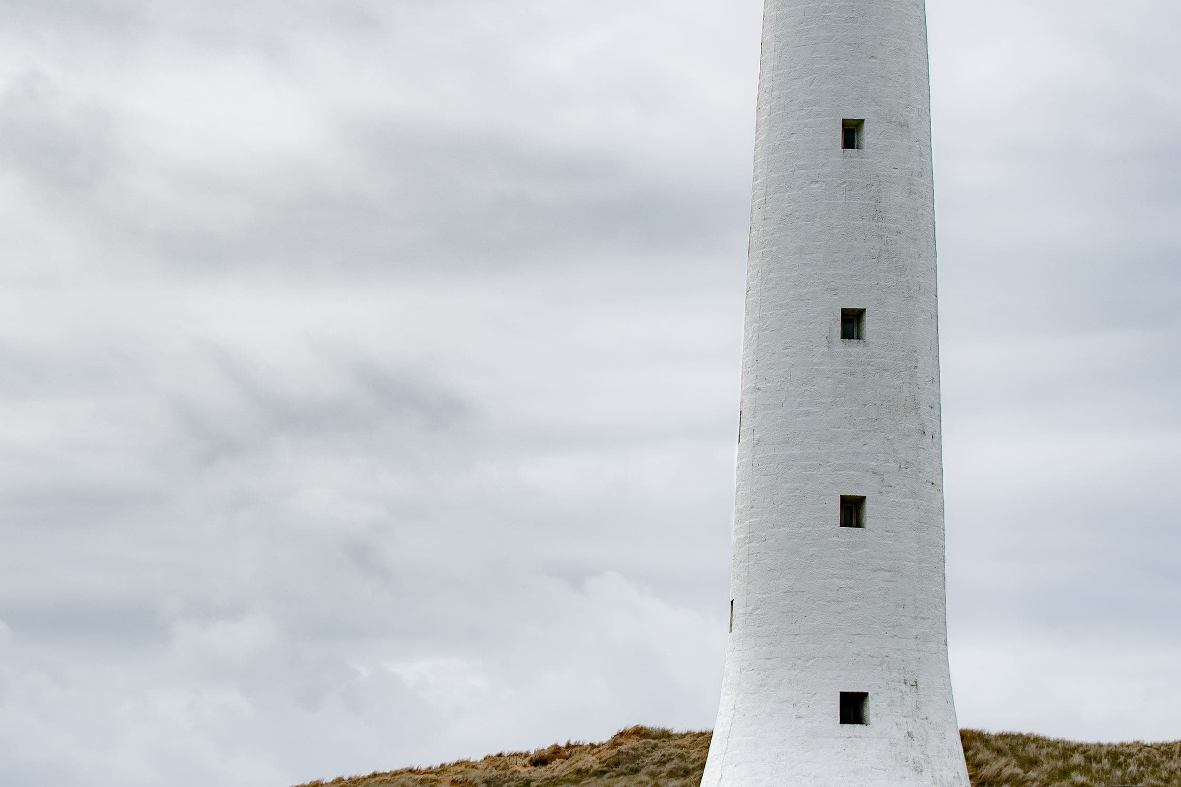
AMSA’s heritage strategy 2022–2025 is the document this guide trusts when a height or a death toll appears. King Island Council is the civic voice that still leads with wrecks and lights. Discover Tasmania is the visitor-facing voice that says the ocean has been death as well as life.
Together they are enough. Forum GPS pins are not.
Why the lights exist
Bass Strait’s western entrance is a working sea with a nineteenth-century body count. AMSA says Cape Wickham is “one of a series of lighthouses erected to light the dangers of King Island and the western entrance to Bass Strait.” That series is bigger than this island — the point is the approach, not a postcard.
If you only remember one official sentence, remember the height and the year: 48 metres, 1861, tallest in Australia. If you remember two, add the Cataraqui.
Cape Wickham — what we will claim
- Constructed 1861
- 48 m tall
- Tallest lighthouse in Australia (AMSA’s words)
- Built in the context of King Island wrecks, including the Cataraqui
- Stands at the northern tip, around which Tourism Tasmania’s golf fact sheet places Cape Wickham Links
- Still an aid, not a retired folly
What we will not claim:
- Tallest in the Southern Hemisphere (a slogan AMSA does not use here)
- A visitor climbing right
- A particular lantern range as if you should navigate by this webpage
- A guaranteed whale from the tee
The photograph on this page is a real Wikimedia Commons image of this tower. Other heroes on the site are atmospheric and labelled as such. We draw that distinction on purpose.
The Cataraqui
AMSA: King Island “was the scene of Australia’s largest maritime disaster when the emigrant ship Cataraqui wrecked, with the loss of 400 lives.”
That sentence is already heavier than a visitor guide. We will not decorate it with unsourced passenger diaries or a “must-see wreck beach” heading. If a memorial is signposted, use the sign. If a local museum or official tourism page offers interpretation, use that. If a blog tells you to pocket a rivet, close the tab.
Other lights and other wrecks
Council’s opening sentence is plural: lighthouses, shipwrecks. King Island’s coast holds more than one story. This guide will not assemble a complete gazetteer from secondary listicles. When we cannot cite a primary page for a second tower or a named wreck, we stay quiet rather than become a copy-paste of Wikipedia.
If you are a specialist reader, AMSA, the Australian National Shipwreck Database, and Tasmanian heritage registers are the correct next doors. We are a visitor guide that refuses to be a poor version of those databases.
Visiting as a guest, not a collector
Daylight. The north cape is a drive (35–45 minutes from the airport in the golf fact sheet). Parks’ wildlife note still applies on the way home.
Weather. BOM 098017 will not save you from spray on granite. A 30-minute look from a safe public point is a visit. A climb onto a wet rock for “the shot” is how heritage coasts make new history.
Golfers. You may meet the tower as architecture beside a public-access course. The fact sheet’s designer names and ranking asides do not make the light a hole sponsor. Stay off restricted ground.
Drones. We are not the Civil Aviation Safety Authority. We will still say: an active light and a breeding coast are bad places to improvise aviation.
How this sits with the old dairy “History.aspx”
The 2009 brand menu used “King Island History” as a dairy-adjacent page title. That URL 301s to the History hub. This guide is the long form. It is island maritime history, not a company timeline.
A pacing suggestion, not a tour
Combine this guide with Three days: one northern half-day for the light, one southern or Currie day for everything else. Do not hunt wrecks until dark. Do not write your name on anything that has already outlived you.
If you leave with only AMSA’s two facts and a slower walk back to the car, the guide worked.
How to read a plaque
A plaque is a primary source you can photograph. Read the whole thing. Do not crop it into a caption that says something the metal did not say. If the plaque and AMSA disagree on a number, note both and leave the argument to historians. Visitor guides that “correct” a memorial from a phone are performing.
Secondary lights
You will meet other white towers and leading marks in photographs and in conversation. Unless we can pin a sentence to AMSA, Parks, or a heritage register, they remain “a light you should identify locally.” Completeness is not worth a wrong height.
The Southern Hemisphere slogan, again
It will keep appearing in itineraries because it sounds larger. AMSA’s 2022–2025 strategy did not use it for Cape Wickham. Lighthouse organisations have publicly pushed back on it. We will keep pushing back. “Tallest in Australia” is already an extraordinary official fact. It does not need a promotion.
Families at the cape
A 48-metre tower is a magnet for children who have just sat in a car. The site is a working aid and a cliff weather system. Hold the conversation about edges in the car, not on the last rock. There is no shame in a twenty-minute look from the safe formed bit and a sandwich in the lee of the vehicle.
Researchers and genealogists
If you came because a name on a passenger list is your name, you are not a tourist in the usual sense. Use libraries, Trove, heritage databases, and on-island interpretation. This guide will not crowdsource a gravesite. It will tell you the official death toll AMSA still prints, and then get out of your way.
Combining this guide with golf without being glib
You can play a public-access course beside a tower that exists because 400 people died. That dual use is already in the official fact sheet. The non-glib version is: know the sentence before you take the selfie. Play. Then read. Or read, then play. Do not treat the tower as a mascot.
A reading order
- AMSA heritage paragraph (height, year, Cataraqui)
- Council’s opening wreck-and-light sentence
- Discover Tasmania’s “ocean has been death” line
- This guide
- Whatever the plaque and the official visitor listings add the week you stand there
That order keeps the facts above the atmosphere.
Night-before card for a cape day
- Daylight enough for 35–45 minutes each way from the airport (fact sheet) plus time on site
- BOM forecast
- A rule about edges, spoken in the car
- No drone plan
- A memorial/plaque intention (read, do not take)
- A backup Currie day if the road or the cloud says no
- The AMSA sentence in your head: 1861, 48 m, tallest in Australia, Cataraqui
If you cannot travel with that sentence, wait until you can. The tower has stood since 1861. It does not need your hurry.
The three official sentences to keep in your pocket
- AMSA: Cape Wickham, constructed 1861, 48 m, tallest lighthouse in Australia; a series of lights for King Island and the western entrance to Bass Strait; the Cataraqui as Australia’s largest maritime disaster, 400 lives.
- King Island Council: an island rich in history, with shipwrecks, lighthouses and jagged reefs.
- Discover Tasmania: the ocean is life and has also been death.
If a brochure adds a wreck tally, a Southern Hemisphere slogan, or a “must climb the tower” line, those three still win.
How this guide sits beside Golf and Beaches
Tourism Tasmania’s golf fact sheet puts a public-access links around the light. Discover Tasmania puts named cliffs and beaches on the same coast. Read Golf if you booked a round. Read Beaches & walks if you booked a walk. Read this guide if you need the reason the headland exists. You can do more than one of those things in a week. You cannot do all of them as scenery only.
What a visitor-guide memorial is allowed to be
A reminder to drive in daylight. A reminder not to take objects. A reminder that 400 is AMSA’s figure, not a metaphor. A reminder that interior access to an active aid is not a tourist right. That is enough memorial for a webpage. The metal on the island can do the rest.
After the cape, the other history
Council’s food sentence is the other half of the island: people stayed and farmed in wind. Read Produce on the same trip if you can do it without turning the memorial into a tasting-room appetiser. The 2009 dairy History.aspx on this domain was brand chronology. It 301s to the history hub, not to a cheese timeline. This guide is the long form of that hub.
If you came only for golf, you can still leave with AMSA’s sentence. If you came only for a photograph, you can still leave the objects where they are. Either version is a better visit than a scavenger hunt this page will not publish.
Questions people actually ask
Can I climb Cape Wickham Lighthouse?
AMSA describes an active, heritage-listed light. Interior access is not a public right we can grant. Check current official or operator notices; do not assume a ticket office.
Where did the Cataraqui wreck?
AMSA locates the disaster on King Island without turning this guide into a pin-drop. Use on-island memorials and heritage interpretation. Do not scramble a grave coast for a photograph.